Polar Airborne Measurements and Arctic Regional Climate Model Simulation Project March 10 to April 08 2018, Villum Station/Greenland |
Scientific Objectives
The general goal of PAMARCMiP is to obtain a comprehensive data set of atmospheric and sea ice properties that will be used to understand and quantify the interaction between atmospheric aerosol, surface optical properties, and clouds in the central Arctic. Strategy
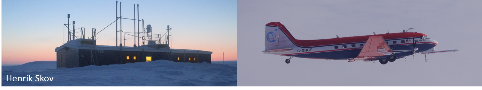
PAMARCMiP combines ground-based stationary and mobile measurements at and in vicinity of the Villum Research Station (Greenland), airborne measurements by the Polar 5 research aircraft, and profiling the atmosphere by tethered-balloon observations. Ground-based activities start from 10. March 2018 and end on 8. April. The Polar 5 aircraft joins one week later from 17. March. While the stationary ground-based observations aim to characterize the temporal evolution of aerosol properties, mobile observations using sledges collect snow samples and chracterize the optical properties of the snow surface on smaller horizontal scales. The airborne observations are used to cover larger scales and the vertical profiles of the atmosphere. Both will be linked by thethered balloon and UAV measurements in the lower atmosphere.
Objectives
| PAMARCMiP aims to characterize the short-term variability, horizontal and vertical distribution of aerosols and black carbon (BC) in the atmosphere and concentrations of BC in snow. Quantifying the distribution of aerosols and BC within the Arctic Atmospheric Boundary Layer (ABL), we aim to estimate deposition rates (wet and dry) of aerosols as well as source regions and the physical/chemical state of the observed BC-containing aerosol. The analyses of both will be used to link the atmospheric BC to the BC in snow on the ground and help to quantify the radiative forcing of BC on the Arctic surface layer. Changes of the surface radiation budget for aerosols originating from long-range transport of anthropogenic and natural and local emitted anthropogenic aerosol will be analyzed. | 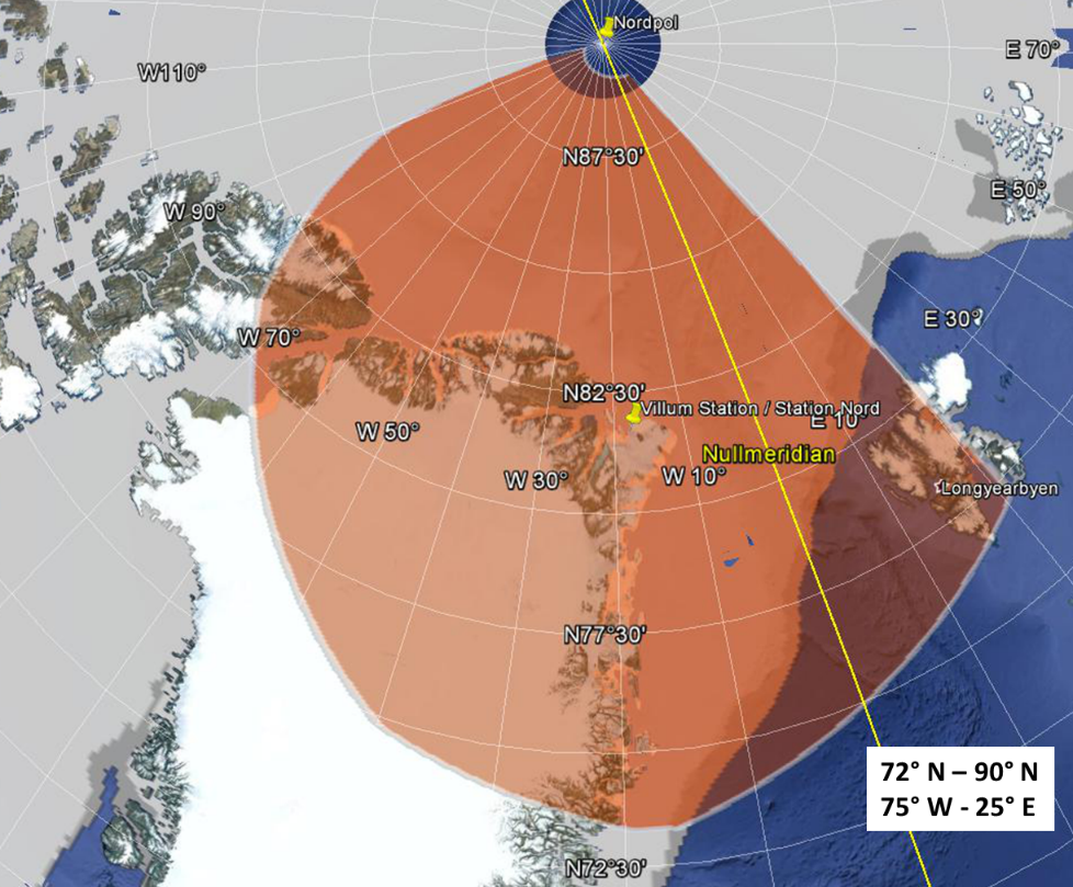
|
Simultaneously, the physical and optical properties of sea ice and snow will be measured (airborne and ground-based). Snow optical properties such as spectral albedo and bidirectional reflectance distribution function (BRDF) will be derived and analyzed in dependence of BC concentrations, snow grain size, surface roughness and the variability of snow and sea ice thickness. The correlation between snow albedo changes and absorptive properties of BC will be evaluated.
The measured spatial and spectral distribution of BRDFs / surface albedo will serve as input for 3D radiative transfer (RT) simulations to quantify 3D radiative effects and their sensitivity on the retrieval of cloud and aerosol properties as well as the sensitivity on the radiative cooling or warming by Arctic clouds which in turn influences feedback mechanisms within the Arctic Amplification.
Measurements of cloud properties will be conducted on the Polar 5 aircraft in cloudy situations. The characterization of cloud macro-and microphysical properties will be used to interpret the aerosol and surface properties in terms of wet deposition, cloud-aerosol interaction, and 3D radiative effects. The cloud radiative forcing will be quantified for a representative area of heterogeneous surfaces in terms of their spectral and spatial variability. The in-situ cloud and aerosol properties will be compared with satellite observations in order to estimate the impact of surface heterogeneities on the retrieval uncertainty of Arctic cloud and aerosol properties.
The tethered balloon platforms will be used to link local ground-based and airborne observations. Profiling the cloudy and cloud-free atmospheric boundary layer, the atmospheric state, turbulent and radiative fluxes, and aerosol concentration throughout the lower atmosphere will be measured to quantify the interaction between the surface layer and free atmosphere.
Location
Ground-based observations will be based at Villum Research Station (Greenland). The operation area of Polar 5 will be mainly above sea ice in the Arctic sea and the Fram Strait. While dense multi-year sea ice is expected north of Greenland, thinner first year sea ice will dominate the sea ice in the Fram Strait. Some flights will focus on the snow properties over the Greenland to be able to compare to the ground-based observations around Villum Research Station.
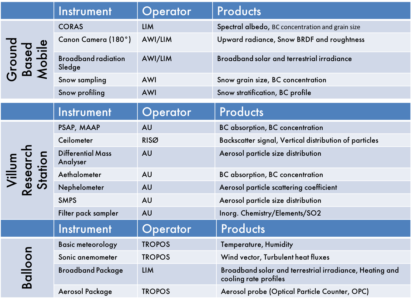
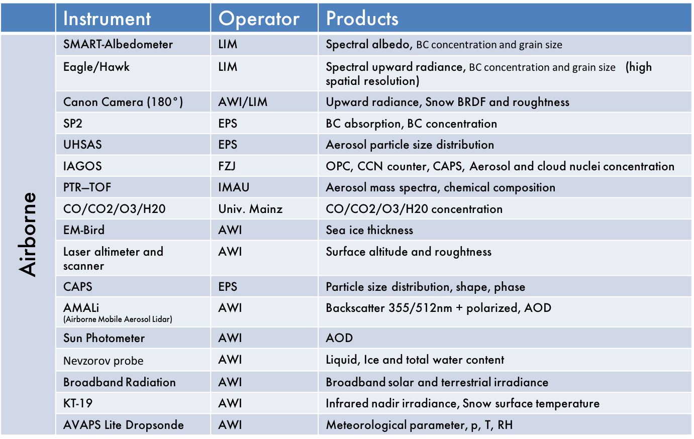
Instrumentation
|
|


