Clouds over cOMPlEX environment March 14 to April 14 2026, Longyearbyen/Svalbard |
Scientific Objectives
COMPEX is a joint project of different German universities and research institutes embedded in the Transregional Collaborative Research Centre TRR 172: ArctiC Amplification: Climate Relevant Atmospheric and SurfaCe Processes, and Feedback Mechanisms (AC)³. The general goal of the COMPEX campaign is the observation and subsequent understanding of Arctic MPCs in complex environments, focusing on (1.) the broader Ny-Ålesund area and (2.) low-level clouds over sea ice. As more technical objectives, we aim (3.) to derive sea ice emissivities to ultimately support the assimilation of satellite data in the Arctic and (4.) to evaluate the performance of EarthCARE’s CPR. Objectives (2.) and (3.) rely on sea ice coverage, which has its maximum extent around Svalbard in spring. Therefore, COMPEX is planned for March/April 2026 with a base in Longyearbyen (Svalbard), which, in addition, extends the datasets from AFLUX and HALO-(AC)³ conducted during the same time of the year in the same region.
Strategy
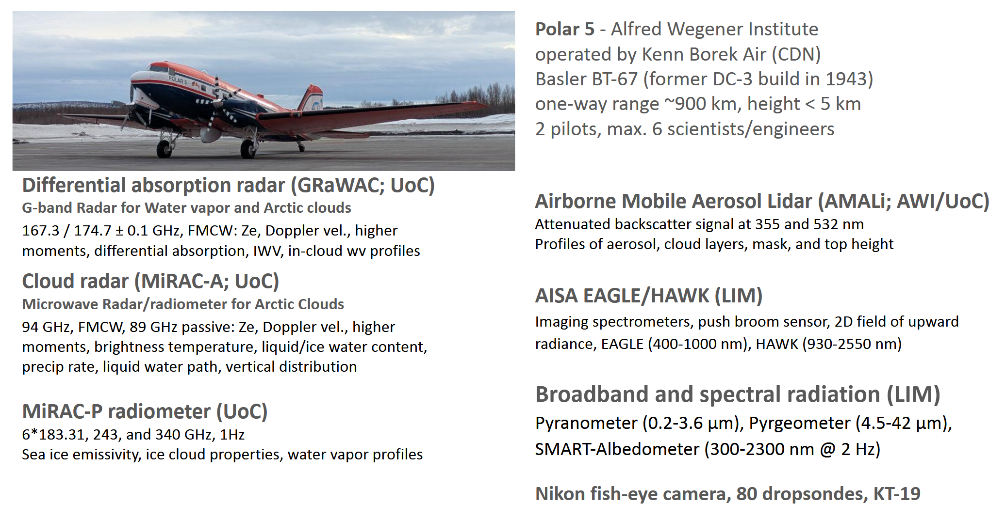
| COMPEX employs the research aircraft, Polar 5, operated by the Alfred Wegener Institute for Marine and Polar research. The research flights aim to measure properties of cloud and sea ice emissivities, the energy fluxes in the atmospheric column including radiative fluxes as well as fluxes of sensible and turbulent latent heat. In total, 80 flight hours within 4 weeks (14. march – 14. April 2026) are planned. Polar 5 will approach the ice-pack mainly in altitudes of 3,000 m (10,000 ft). The configuration on the aircraft for this campaign will consist mostly of cloud remote sensing instruments looking downward. Except for the lidar, which must be operated only at altitudes above 9,000 ft for safety reasons, all other instruments do not require a specific flight altitude. Radar measurements get disturbed by strong ground reflections when operated in altitudes below 1500 ft. Therefore, flights with a focus on clouds will be conducted at altitudes between 9,000 and 12,000 ft. For the sea ice emissivity measurements, lower flight altitudes are planned at 2000 ft. Apart from during takeoff and landing, no flights are required in clouds or at very low altitudes. The base for the aircraft operation will be Longyearbyen, (Svalbard lufthavn, LYR). The airborne observations will be closely coordinated with surface based observations at the AWIPEV station (Ny Ålesund). | 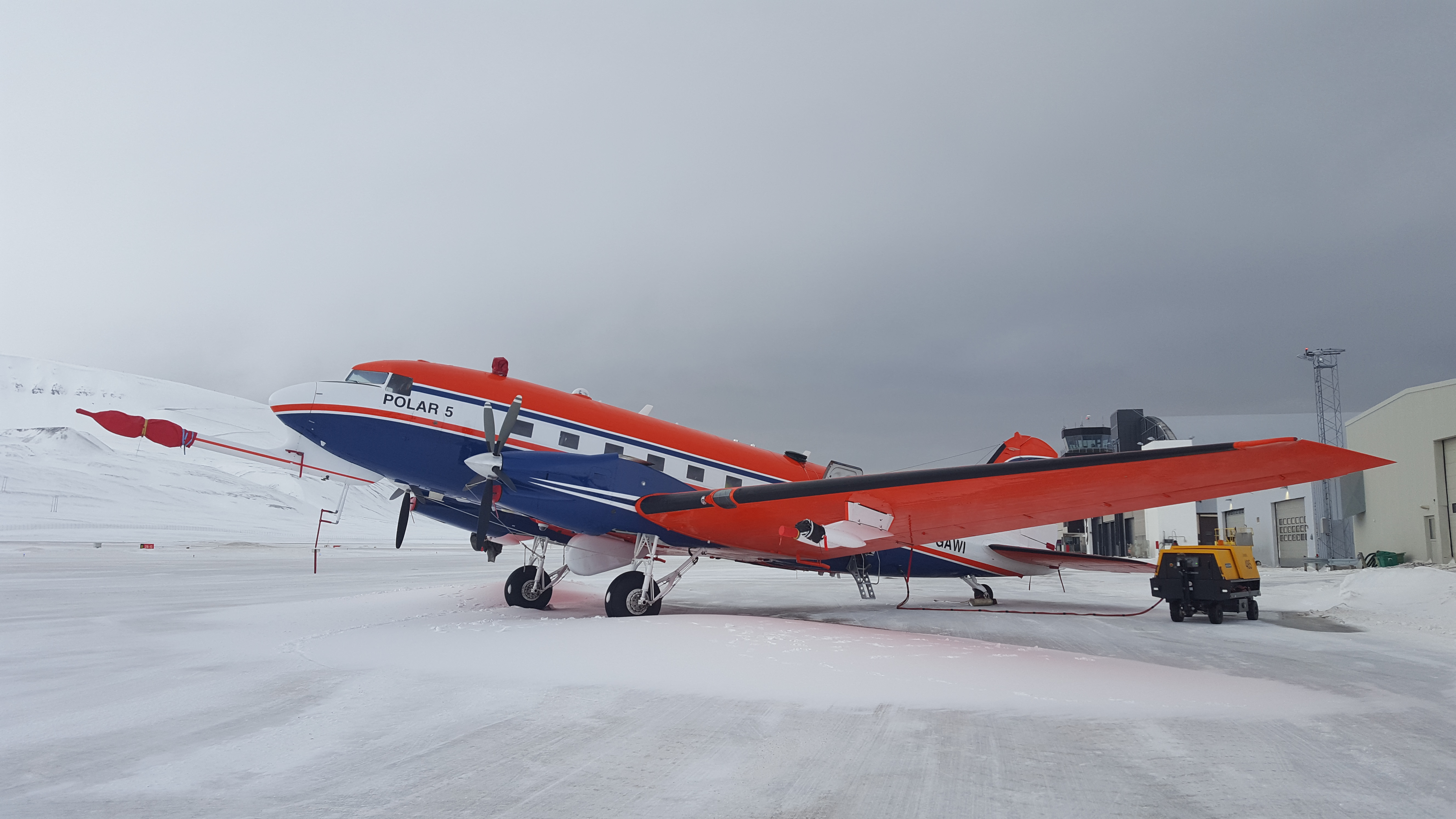
|
Objectives and work program
Based on the former research efforts performed within (AC)³, we identified gaps in our knowledge, which we aim to close by COMPEX.
- 1. Cloud systems in the vicinity of Ny-Ålesund and Kongsfjorden
Using the detailed vertical cross-sections of cloud and precipitation properties together with imaging from AISA/HAWK and the continuous measurements at AWIPEV, we will address the following questions:
- How do cloud fields develop when air masses flow into or out of Kongsfjorden and how do they relate to measurements at AWIPEV research base (E02, E04)?
- Can the high-resolution ICON-LEM model reproduce the general characteristics of the changing cloud field? What is the effect of model resolution (E03)?
- Which are the factors controlling cloud phase and precipitation occurrence in mixed-phase clouds (B03, E03, CCA3)?
- Under which conditions does significant sublimation or evaporation occur, and how does the resulting moistening and cooling of the sub-cloud layer feed back on cloud properties (E05)?
- 2. Low-level clouds over sea ice
Cloud measurements over sea ice are extremely challenging for satellites. Therefore, the observation-based knowledge on clouds is limited, in particular with respect to how CAOs are preconditioned in the marginal sea ice zone. Furthermore, research flights during previous campaigns were primarily focused on measuring turbulence and fluxes near the surface, with limited flight hours dedicated to remote sensing measurements from above. The following questions emerge:
- What are the driving factors of low-level stratus cloud occurrence in the marginal sea ice zone (A01)?
- What can we learn about liquid and ice properties within the clouds and their spatial variability from the novel remote sensing measurements (E03)?
- How important is atmospheric preconditioning over sea ice for the development of cold air outbreaks (B03)?
- How do our clouds fit into the satellite-based cloud atlas that was observed in this area?
- 3. Sea ice emissivity
Data assimilation of microwave satellite measurements is a key factor for numerical weather prediction. In particular, assimilation of water vapor frequencies has improved forecast skills in recent years. Nevertheless, assimilation over sea ice is still limited due to gaps in the characterization of sea ice emissivity. Here, we aim to leverage passive microwave measurements with MiRAC-P, which features frequency channels comparable to those of instruments on upcoming satellite missions, such as the ICI on the MetOp Second Generation mission or the AWS.
- How strongly does sea ice emissivity change at millimeter and submillimeter wavelengths in the (marginal) sea ice zone?
- What is the spectral variation of sea ice emissivity over different surfaces, and can we identify certain clusters that can be exploited for parameterization development?
- 4. Satellite underflights
According to current plans, the EarthCARE satellite will be flying during the campaign, and we will plan for underflights of approximately. 20 min. Approximately 1-3 overpasses of EarthCARE can be expected per day in the COMPEX survey area. Similar underflight patterns have been successfully performed during ACLOUD and AFLUX campaigns for CloudSat. ESA has expressed its interest in such validation flights, including the novel G-band radar measurements acting as a prototype for future radar satellite missions.
- How well do EarthCARE reflectivity profiles agree with those measured by DRACO?
- What is the benefit of EarthCARE’s Doppler capability and improved blind zone compared to CloudSat?
- What additional knowledge can we gain by incorporating DAR water vapor profiling (as a potential future space mission) into our understanding of cloud processes?
Instrumentation